
New paper: New data of predicted temperate forest structure in Eastern North America
New Paper out!
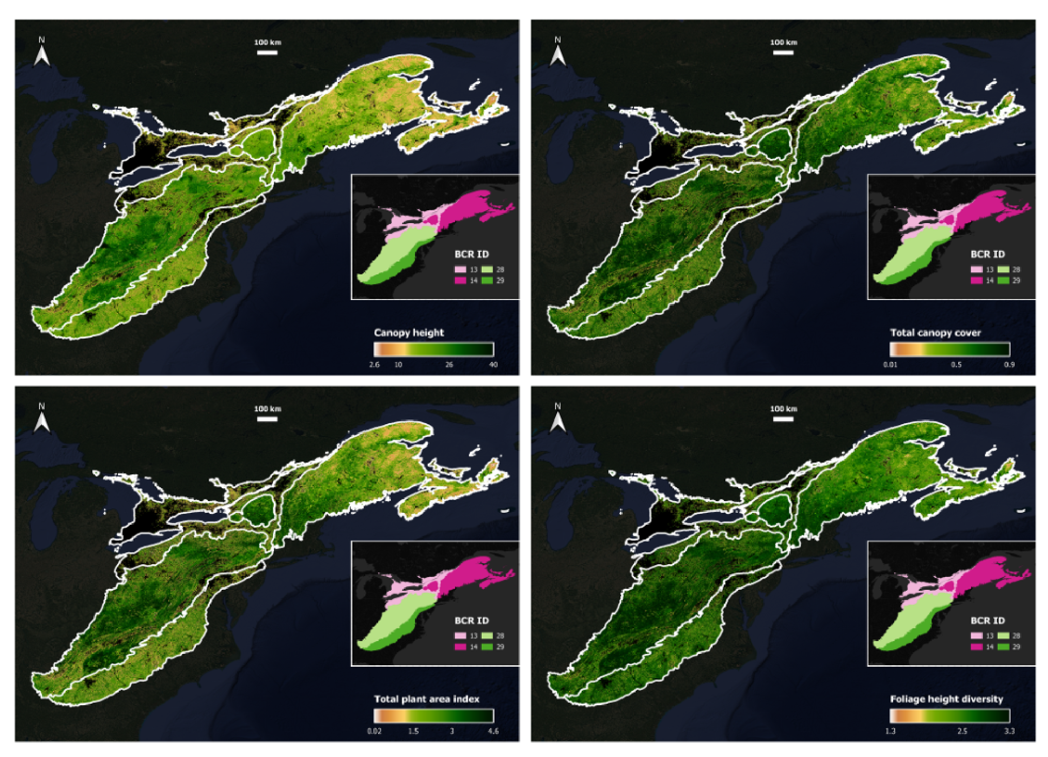
Chenyang led a paper, published this week in Environmental Research Communications, that provides access to new modeled data on forest structure across eastern North America. We used LiDAR (specifically, GEDI), radar, and optical data to predict a suite of continuous metrics such as canopy cover, foliage height density, and canopy height, among others. The work was funded by the National Science Foundation grant.
Abstract
Forest structure underpins the emergence of ecological patterns and processes yet remains costly to measure directly at broad scales. NASA’s Global Ecosystem Dynamics Investigation (GEDI) mission provides three-dimensional LiDAR measurements at discrete footprints, leaving spatial gaps that complicate wall-to-wall mapping. Few studies have produced high-resolution, broad-extent predictions of multiple GEDI-derived metrics while explicitly accounting for spatial nonstationarity in predictor–response relationships. We addressed this gap by developing a local modeling framework to predict 11 GEDI-based structural metrics at 30-m resolution across temperate broadleaf and mixed forests of eastern North America (1.17 million km2) for 2019–2022. Using Google Earth Engine, we first integrated Landsat and Sentinel-2 multispectral imagery, Sentinel-1 synthetic aperture radar, and auxiliary variables (topography, land cover, leaf traits, and soil properties) to derive 93 environmental covariates. We then partitioned the study area into 1,693 overlapping tiles of 60 km by 60 km each, trained tile-specific random forest (RF) models, and mosaiced tile-level predictions to the full region using distance- and performance-based weights. Local tile-specific predictions of the 11 metrics correlated well with GEDI measurements (Pearson’s r > 0.65). Assessments with independent test data showed that median R2 of local models exceeded 0.4 for seven metrics, with canopy height and canopy cover both reaching 0.63. The most important predictors included Sentinel-2, topography, and Landsat, identified in at least 69.6% of local RF models. Compared with global full-region models, local models performed better in 56.7% of cases overall, with stronger gains in more heterogeneous tiles and in settings where global models performed relatively poorly. Our results show that, despite overall moderate predictive performance, integrating spaceborne LiDAR with multisource environmental covariates in a local modeling framework can generate continuous, fine-resolution predictions of forest structure across broad geographic regions.